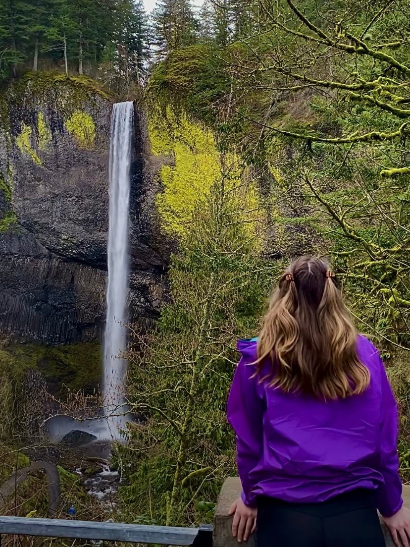
Latourell Falls is a popular waterfall located just 30 minutes outside of Portland, Oregon. This waterfall is located in the Columbia River Gorge at Guy W. Talbot State Park. It’s close to a few other popular hikes in the Columbia River Gorge including Multnomah Falls, Wahkeena Falls, and Wahclella Falls. I also included Latourell Falls in my guide to the best hikes in the Columbia River Gorge! It’s a great waterfall and hike to visit for tourists or locals alike. In this hiking guide, I am covering how to get there, what to expect on the hike, and other tips for Latourell Falls.
Disclaimer: This post contains affiliate links. This means that I get compensated a small amount if purchased through one of these links at no extra cost to you. I always only link products I truly love and any profit made goes to running this blog. Thank you for your support! For more on my disclaimers, you can click here.
Hiking Guide to Latourell Falls
GETTING THERE
If you’re coming from Portland, you will follow I-84 East for 25 miles. You will take exit 28 and take a left onto Historic Columbia River Highway. You will continue on for just 3 miles and the parking lot will be on your left after Bridal Veil Falls. There is no parking fee or pass required. At the trailhead, you can find bathrooms, picnic tables, and garbage cans. Make sure to pack out all of your garbage and stay on the trail when you start your hike. This preserves the hike for others and limits the damage to the area.
THE HIKE
Latourell Falls is the third largest waterfall in the Columbia River Gorge. There is a viewpoint of the falls up a short set of stairs and hill if you don’t opt to complete the entire hike. If you are going to complete the entire hike, it’s a 3-mile loop with an elevation gain of 728 ft. It’s rated moderate on AllTrails, which I would say is pretty accurate. There are uphill areas, but none are too steep. This is a great hike for everyone including beginner hikers, kids, and dogs.
The trail is wide in most places and fairly smooth aside from a few rocky areas near the base of the upper and lower falls. The trail itself is also well-distinguishable, aside from one area after you reach the upper falls if you’re heading in a clockwise direction. If you are headed clockwise, there is a fork in the trail with one path leading to the left, and the other following the water downstream. The path to the left will take you to the road, away from the lower falls. I recommend taking the path to the right which follows the water and will lead you to the bottom of the falls.
If you take the trail on the left on accident, you will need to take a right on the road and cross the bridge to lead you back to the parking lot. if you still want to see the lower falls, you can take the paved path to the right of the visitor board to follow the path counter-clockwise.
OTHER TIPS
Compared to the other hikes in the area, this hike doesn’t get pretty busy. There will be other hikers during weekdays and weekends year-round (especially the weekend!). If it’s the weekend, make sure you arrive early for parking. The parking lot is pretty big and can fit about 50 cars. When I arrived around 10:00 on a Wednesday in the off-season, there were only 2-3 other cars. By the time we were getting ready to leave around noon, the parking lot was pretty full. I think it would only be a problem if you’re visiting on the weekend, especially in the summer. Bridal Veil Falls is close by with a fairly large parking lot and is only a short hike. If the parking lot is full, consider hiking to Bridal Veil (only 2/3 mile) and checking back.
In the past, there have been reports of car break-ins. This is possible at any trailhead, I’ve even seen it at more remote hiking locations. It doesn’t seem like it has been as commonly lately, at the time of writing this post. Just make sure to take normal precautions and don’t keep anything valuable in your car. You can also check the recent AllTrails reviews to see if there have been any break-ins around the time you’re planning to hike.
In the winter on colder mornings, the trail can get pretty slippery. Make sure to bring shoes with traction at the very least if it’s especially cold, or consider microspikes. The slippery areas are concentrated mostly around the falls, where it stays pretty damp. The trail can also get muddy in spots during the rainy season, so I would suggest a pair of hiking boots. In the warmer months, tennis shoes would work fine!
Other Hikes
Since this hike is on the shorter side, it’s great to add a few other short hikes in the area if you’re visiting from a different area! I recommend the ones I listed at the beginning of this post as a place to start. If you’re not up to hiking more, but you do want to see another waterfall, you can park at the Multnomah Falls parking lot (no fee needed) that is just up the road. Multnomah Falls is the most popular waterfall in the gorge and you don’t need to hike it to see it. There is a lodge that you can visit for coffee, food, and gifts, and you can walk on the paved path to see the view only 5 minutes from the parking lot!
If you enjoyed this post or are looking for other hikes in the Pacific Northwest area, be sure to check out the other hikes that I’ve posted. I linked a few of my favorite hikes in the area below!
- Lewis River Falls | Trail Route, Hiking Tips + Best Time to Visit!
- Trail of Ten Falls: Silver Falls State Park
- The Best Hikes in the Gifford Pinchot National Forest
Thank you so much for reading! If you want to follow along on my hikes and get notified when I post new posts, be sure to follow my Instagram @maddie_deer here or like my Facebook page here.


